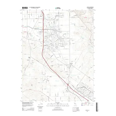
2015 Map of Cotati
USGS Topo · Published 2015About this map
Cotati serves as the central hub of this Sonoma County landscape, where the urban grid meets the agricultural reaches of the Petaluma River valley. The map documents a blend of academic and rural life, featuring the campus of Sonoma State Univ on the eastern edge of the city. To the south, the terrain rises toward Meacham Hill and Wiggins Hill, overlooking small settlements like Penngrove and Liberty.
Find a feature on this map
34 named features on this map. Tap any name to fly to it.
Don’t see what you’re looking for? This feature index may not catch every label — zoom into the map to look around manually.
Map Details
Editions of this 2015 Cotati Map
This is the sole edition of this map. No revisions or reprints were ever made.
Other maps of this area

1914 · Petaluma
USGS Topo · 1:62,500

1916 · Santa Rosa
USGS Topo · 1:62,500

1916 · Point Reyes
USGS Topo · 1:48,000

1918 · Point Reyes
USGS Topo · 1:62,500

1935 · Sebastopol
USGS Topo · 1:48,000

1942 · Sebastopol
USGS Topo · 1:62,500

1942 · Petaluma
USGS Topo · 1:62,500

1944 · Santa Rosa
USGS Topo · 1:62,500

1947 · Santa Rosa
USGS Topo · 1:250,000

1949 · Santa Rosa
USGS Topo · 1:250,000