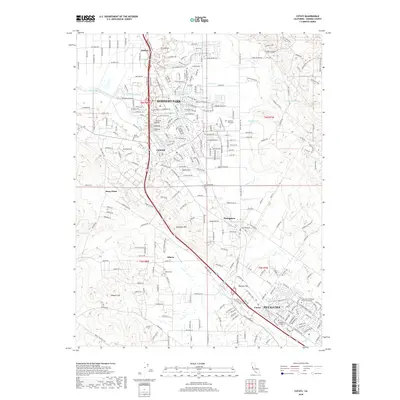
2018 Map of Cotati
USGS Topo · Published 2018About this map
Rohnert Park and Cotati anchor this detailed study of the Sonoma County landscape, illustrating the suburban and educational infrastructure that has defined the region in the early 21st century. The map highlights the extensive footprint of Sonoma State University and the Santa Rosa Jr College Petaluma Campus, marking these institutions as central hubs of the local community. These campuses are surrounded by a complex network of residential streets and creek corridors like Hinebaugh Creek and Copeland Creek.
Find a feature on this map
175 named features on this map. Tap any name to fly to it.
Don’t see what you’re looking for? This feature index may not catch every label — zoom into the map to look around manually.
Map Details
Editions of this 2018 Cotati Map
This is the sole edition of this map. No revisions or reprints were ever made.
Other maps of this area

1914 · Petaluma
USGS Topo · 1:62,500

1916 · Santa Rosa
USGS Topo · 1:62,500

1916 · Point Reyes
USGS Topo · 1:48,000

1918 · Point Reyes
USGS Topo · 1:62,500

1935 · Sebastopol
USGS Topo · 1:48,000

1942 · Sebastopol
USGS Topo · 1:62,500

1942 · Petaluma
USGS Topo · 1:62,500

1944 · Santa Rosa
USGS Topo · 1:62,500

1947 · Santa Rosa
USGS Topo · 1:250,000

1949 · Santa Rosa
USGS Topo · 1:250,000