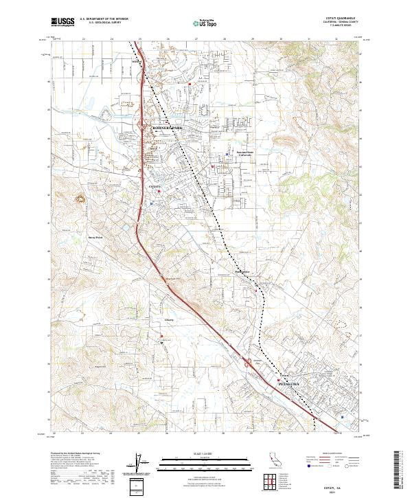
2021 Map of Cotati
USGS Topo · Published 2021About this map
The Rohnert Park and Cotati corridor forms the heart of this landscape, where the flat valley floor meets the rising elevations of the Sonoma mountains. The map traces the upper reaches of the Petaluma River, which flows south toward Petaluma, while the Laguna de Santa Rosa and Hinebaugh Creek drain the northern reaches. This 2021 study documents the significant educational footprint in the region, centered on the Sonoma State University campus and the Santa Rosa Junior College Petaluma Campus.
Find a feature on this map
42 named features on this map. Tap any name to fly to it.
Don’t see what you’re looking for? This feature index may not catch every label — zoom into the map to look around manually.
Map Details
Editions of this 2021 Cotati Map
This is the sole edition of this map. No revisions or reprints were ever made.
Other maps of this area

1914 · Petaluma
USGS Topo · 1:62,500

1916 · Santa Rosa
USGS Topo · 1:62,500

1916 · Point Reyes
USGS Topo · 1:48,000

1918 · Point Reyes
USGS Topo · 1:62,500

1935 · Sebastopol
USGS Topo · 1:48,000

1942 · Sebastopol
USGS Topo · 1:62,500

1942 · Petaluma
USGS Topo · 1:62,500

1944 · Santa Rosa
USGS Topo · 1:62,500

1947 · Santa Rosa
USGS Topo · 1:250,000

1949 · Santa Rosa
USGS Topo · 1:250,000