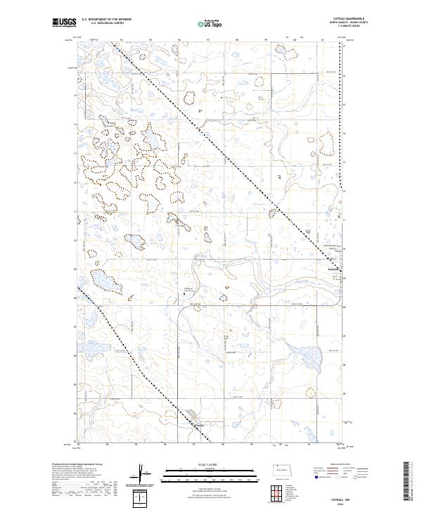
2024 Map of Coteau
USGS Topo · Published 2024About this map
Coteau and the surrounding prairie of Burke County appear here as a landscape defined by both modern conservation and deep-rooted agricultural settlement. The topography is marked by numerous glacial potholes and wetlands, including the protected Burke County Waterfowl Production Area, which provides critical habitat among the section lines. Water moves through the terrain via Stony Creek and the meandering Shockley Slough, carving gentle depressions into the high plains. For those tracing local heritage, the Bethlehem Lutheran Cem stands as a focal point in the rural township, situated north of the Coteau townsite. Near the eastern edge, the influence of the county seat is visible at the Bowbells Municipal Airport and the outskirts of Bowbells. A rigid grid of county roads, such as Co Rd 8 and Co Rd 15, anchors the region's ranching and farming operations.
Find a feature on this map
30 named features on this map. Tap any name to fly to it.
Don’t see what you’re looking for? This feature index may not catch every label — zoom into the map to look around manually.
Map Details
Editions of this 2024 Coteau Map
This is the sole edition of this map. No revisions or reprints were ever made.
Other maps of this area

1947 · Bowbells NW
USGS Topo · 1:24,000

1947 · Flaxton
USGS Topo · 1:24,000

1947 · Bowbells
USGS Topo · 1:24,000

1948 · Flaxton
USGS Topo · 1:24,000

1948 · Coteau
USGS Topo · 1:24,000

1948 · Woburn
USGS Topo · 1:24,000

1948 · Vanville NE
USGS Topo · 1:24,000

1949 · Bowbells
USGS Topo · 1:24,000

1949 · Bowbells NW
USGS Topo · 1:24,000

1949 · Niobe
USGS Topo · 1:24,000