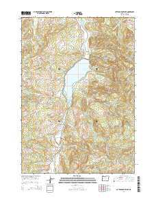
2014 Map of Cottage Grove Lake
USGS Topo · Published 2014About this map
Cottage Grove Lake dominates the central landscape of this 2014 survey, formed by the impoundment of the Coast Fork Willamette River. The map details the rural character of southern Lane County, centered on the small settlements of London and London Springs tucked into the valley south of the reservoir. A network of logging and access roads, including several BLM roads and the Weyerhauser Rd, lace through the surrounding heights such as Hoodoo Mtn and Brush Mtn. Genealogists and local historians can locate the Taylor-Lane Cem in the north and the Lone Pine Cem near the river, along with historic crossings like Army Bridge and Thorne Bridge. The transition from the flat waters of the lake to the high ridges of White Rock Ridge and Laurel Butte illustrates the varying geography of the t21s r3w and t22s r3w townships.
Find a feature on this map
83 named features on this map. Tap any name to fly to it.
Don’t see what you’re looking for? This feature index may not catch every label — zoom into the map to look around manually.
Map Details
Editions of this 2014 Cottage Grove Lake Map
This is the sole edition of this map. No revisions or reprints were ever made.
Other maps of this area

1921 · Cottage Grove
USGS Topo · 1:62,500

1935 · Lowell
USGS Topo · 1:96,000

1942 · Lowell
USGS Topo · 1:125,000

1954 · Anlauf
USGS Topo · 1:62,500

1955 · Culp Creek
USGS Topo · 1:62,500

1955 · Lowell
USGS Topo · 1:62,500
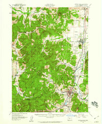
1957 · Cottage Grove
USGS Topo · 1:62,500

1958 · Roseburg
USGS Topo · 1:250,000

1959 · Roseburg
USGS Topo · 1:250,000

1979 · Cottage Grove
USGS Topo · 1:100,000