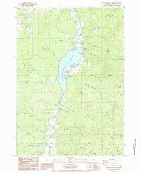
1987 Map of Cottage Grove Lake
USGS Topo · Published 1987About this map
Cottage Grove Lake dominates this 1980s landscape, formed by the impoundment of the Coast Fork Willamette River. The map captures a transition between water-based recreation and the surrounding timbered uplands, shown through established sites like Pine Meadows Campground, Lakeside Park, and Wilson Creek Park. South of the reservoir, the small settlements of London and London Springs sit near the confluence of Hobart Creek and Anderson Creek, providing a look at the community structure of the upper Coast Fork valley before later development.
Find a feature on this map
58 named features on this map. Tap any name to fly to it.
Don’t see what you’re looking for? This feature index may not catch every label — zoom into the map to look around manually.
Map Details
Editions of this 1987 Cottage Grove Lake Map
This is the sole edition of this map. No revisions or reprints were ever made.
Other maps of this area

1921 · Cottage Grove
USGS Topo · 1:62,500

1935 · Lowell
USGS Topo · 1:96,000

1942 · Lowell
USGS Topo · 1:125,000

1954 · Anlauf
USGS Topo · 1:62,500

1955 · Culp Creek
USGS Topo · 1:62,500

1955 · Lowell
USGS Topo · 1:62,500
1957 · Cottage Grove
USGS Topo · 1:62,500

1958 · Roseburg
USGS Topo · 1:250,000

1959 · Roseburg
USGS Topo · 1:250,000

1979 · Cottage Grove
USGS Topo · 1:100,000