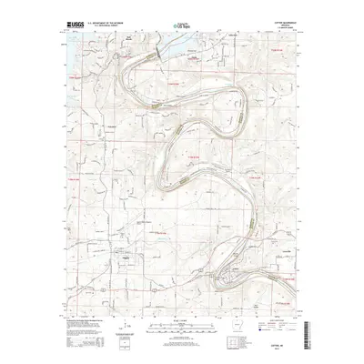
2014 Map of Cotter
USGS Topo · Published 2014About this map
The White River carves a deep, serpentine path through the Ozark landscape, defining the boundary between Marion and Baxter counties. This 2014 survey documents the region as a hub of aviation and river recreation, anchored by the Marion County Regional Airport and the sprawling waters of Bull Shoals Lake. The topography is marked by steep elevations like Lee Mtn and Bull Shoals Mtn, which drop sharply into the river valley where Cane Island and Bayless Island sit within the current.
Find a feature on this map
52 named features on this map. Tap any name to fly to it.
Don’t see what you’re looking for? This feature index may not catch every label — zoom into the map to look around manually.
Map Details
Editions of this 2014 Cotter Map
This is the sole edition of this map. No revisions or reprints were ever made.
Other maps of this area

1890 · Mountain Home
USGS Topo · 1:125,000

1891 · Mountain Home
USGS Topo · 1:125,000

1893 · Yellville
USGS Topo · 1:125,000

1894 · Mountain Home
USGS Topo · 1:125,000

1903 · Yellville
USGS Topo · 1:125,000

1905 · Yellville
USGS Topo · 1:125,000

1929 · Yellville
USGS Topo · 1:125,000

1945 · Harrison
USGS Topo · 1:250,000

1949 · Harrison
USGS Topo · 1:250,000

1954 · Harrison
USGS Topo · 1:250,000