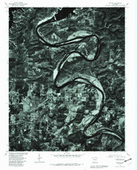
1979 Map of Cotter
USGS Topo · Published 1981About this map
The winding White River defines the landscape of this 1979 orthophotograph, carving deep loops through the terrain of Marion and Baxter Counties. This imagery, captured by the Geological Survey and the Soil Conservation Service, provides a detailed view of the regional centers of Cotter and Flippin at a time of established lakeside and riverfront development. To the north, the expanse of Bull Shoals Lake meets the upper reaches of the river, while the settlement of Lakeview sits near the water's edge. The high-altitude photography reveals the intricate patterns of forest and cleared farmland, showing how local communities like Gassville and Fairview integrated with the dramatic river bends. Crooked Creek is also visible, threading through the southwestern portion of the quadrangle before its eventual confluence with the White River.
Find a feature on this map
12 named features on this map. Tap any name to fly to it.
Don’t see what you’re looking for? This feature index may not catch every label — zoom into the map to look around manually.
Map Details
Editions of this 1979 Cotter Map
This is the sole edition of this map. No revisions or reprints were ever made.
Other maps of this area

1890 · Mountain Home
USGS Topo · 1:125,000

1891 · Mountain Home
USGS Topo · 1:125,000

1893 · Yellville
USGS Topo · 1:125,000

1894 · Mountain Home
USGS Topo · 1:125,000

1903 · Yellville
USGS Topo · 1:125,000

1905 · Yellville
USGS Topo · 1:125,000

1929 · Yellville
USGS Topo · 1:125,000

1945 · Harrison
USGS Topo · 1:250,000

1949 · Harrison
USGS Topo · 1:250,000

1954 · Harrison
USGS Topo · 1:250,000