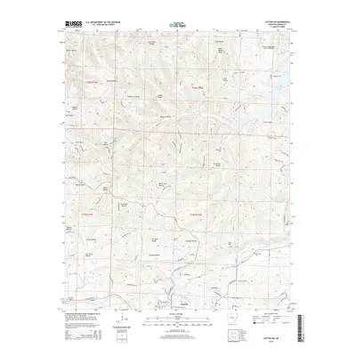
2014 Map of Cotter SW
USGS Topo · Published 2014About this map
Summit anchors the southern portion of this landscape, situated near the intersection of several local drainage systems like Fallen Ash Cr and E Prong Town Br. The terrain is defined by a dense network of ridges and hollows, where family-named landmarks such as Sharpy Jim Ridge, Wolf Wallow Ridge, and Lee Mtn provide essential geographic orientation for the local community.
Find a feature on this map
110 named features on this map. Tap any name to fly to it.
Don’t see what you’re looking for? This feature index may not catch every label — zoom into the map to look around manually.
Map Details
Editions of this 2014 Cotter SW Map
This is the sole edition of this map. No revisions or reprints were ever made.
Other maps of this area

1893 · Yellville
USGS Topo · 1:125,000

1903 · Yellville
USGS Topo · 1:125,000

1905 · Yellville
USGS Topo · 1:125,000

1929 · Yellville
USGS Topo · 1:125,000

1945 · Harrison
USGS Topo · 1:250,000

1949 · Harrison
USGS Topo · 1:250,000

1954 · Harrison
USGS Topo · 1:250,000

1958 · Harrison
USGS Topo · 1:250,000

1964 · Harrison
USGS Topo · 1:250,000
1966 · Yellville
USGS Topo · 1:24,000