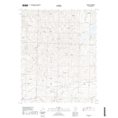
2020 Map of Cotter SW
USGS Topo · Published 2020About this map
Summit anchors the southern portion of this Marion County landscape, situated where the Missouri & Northern Arkansas Railroad corridor once influenced local commerce. The topography is defined by the deep incisions of the Ozark Plateau, featuring prominent landmarks like Sharpy Jim Ridge and the aptly named The Rock House. To the northeast, the reach of Bull Shoals Lake touches the map, while numerous hollows—such as Lean Mine Hollow and Onwata Hollow—illustrate the complex drainage patterns feeding into Fallen Ash Creek and the Brushy Fork. This terrain reveals a rural history of small-scale mining and agricultural persistence. Genealogists will find several burial sites preserved across the ridges and valleys, including the Georges Creek Cemetery and the more remote Moccasin Cemetery, providing specific points of interest for family history research in north-central Arkansas.
Find a feature on this map
129 named features on this map. Tap any name to fly to it.
Don’t see what you’re looking for? This feature index may not catch every label — zoom into the map to look around manually.
Map Details
Editions of this 2020 Cotter SW Map
This is the sole edition of this map. No revisions or reprints were ever made.
Other maps of this area

1893 · Yellville
USGS Topo · 1:125,000

1903 · Yellville
USGS Topo · 1:125,000

1905 · Yellville
USGS Topo · 1:125,000

1929 · Yellville
USGS Topo · 1:125,000

1945 · Harrison
USGS Topo · 1:250,000

1949 · Harrison
USGS Topo · 1:250,000

1954 · Harrison
USGS Topo · 1:250,000

1958 · Harrison
USGS Topo · 1:250,000

1964 · Harrison
USGS Topo · 1:250,000
1966 · Yellville
USGS Topo · 1:24,000