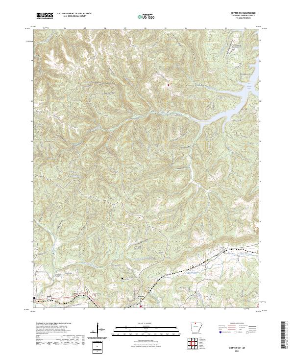
2024 Map of Cotter SW
USGS Topo · Published 2024About this map
The settlement of Summit serves as the primary anchor in this portion of Marion County, where the terrain is defined by a dense network of ridges and deep hollows. The landscape is marked by landmarks like Sunset Ridge and Lee Mtn, while the northern reaches include a portion of Bull Shoals Lake. This area reflects a long-standing rural structure where cemeteries such as Mountain View Cem and Moccasin Cem are situated on higher ground, often overlooking the various branches and creeks that drain the territory. The presence of Lean Mine Hollow suggests historical resource extraction, while Elephant Spring and Thunder Ridge Ranch Airport represent distinct points of interest within the topography. Waterways like Fallen Ash Creek and Jimmie Creek carve through the land, illustrating the drainage patterns that have historically shaped local property boundaries and access routes.
Find a feature on this map
118 named features on this map. Tap any name to fly to it.
Don’t see what you’re looking for? This feature index may not catch every label — zoom into the map to look around manually.
Map Details
Editions of this 2024 Cotter SW Map
This is the sole edition of this map. No revisions or reprints were ever made.
Other maps of this area

1893 · Yellville
USGS Topo · 1:125,000

1903 · Yellville
USGS Topo · 1:125,000

1905 · Yellville
USGS Topo · 1:125,000

1929 · Yellville
USGS Topo · 1:125,000

1945 · Harrison
USGS Topo · 1:250,000

1949 · Harrison
USGS Topo · 1:250,000

1954 · Harrison
USGS Topo · 1:250,000

1958 · Harrison
USGS Topo · 1:250,000

1964 · Harrison
USGS Topo · 1:250,000
1966 · Yellville
USGS Topo · 1:24,000