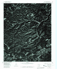
1979 Map of Cotter SW
USGS Topo · Published 1981About this map
Bull Shoals Lake dominates the northeastern corner of this orthophotomap, its dendritic shoreline reaching into the deeply dissected hills of Marion County. This 1979 aerial perspective, produced by the Geological Survey in cooperation with the Soil Conservation Service, provides a high-contrast view of the land use patterns and natural drainages typical of the Ozark plateau. Central to the landscape is the winding course of Jimmie Creek, which cuts through the terrain west of the high point at Summit. The imagery reveals a complex network of ridgelines and hollows, where the light-toned paths of rural roads trace the easiest gradients across the landscape, connecting isolated homesteads and clearings to the larger regional watershed.
Find a feature on this map
3 named features on this map. Tap any name to fly to it.
Don’t see what you’re looking for? This feature index may not catch every label — zoom into the map to look around manually.
Map Details
Editions of this 1979 Cotter SW Map
This is the sole edition of this map. No revisions or reprints were ever made.
Other maps of this area

1893 · Yellville
USGS Topo · 1:125,000

1903 · Yellville
USGS Topo · 1:125,000

1905 · Yellville
USGS Topo · 1:125,000

1929 · Yellville
USGS Topo · 1:125,000

1945 · Harrison
USGS Topo · 1:250,000

1949 · Harrison
USGS Topo · 1:250,000

1954 · Harrison
USGS Topo · 1:250,000

1958 · Harrison
USGS Topo · 1:250,000

1964 · Harrison
USGS Topo · 1:250,000
1966 · Yellville
USGS Topo · 1:24,000