
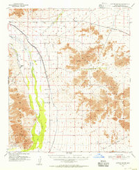
1951 Map of Cotton Center
USGS Topo · Published 1952About this map
Cotton Center and the Enterprise Ranch sit at the heart of this desert landscape, where the Gila River provides a vital corridor of life between the Buckeye Hills and the Maricopa Mountains. The map illustrates the sophisticated mid-century water management necessary for agricultural survival in this arid region, showing the Gila Bend Canal, the Enterprise Canal, and a prominent Diversion Dike used to redirect seasonal runoff.
Find a feature on this map
14 named features on this map. Tap any name to fly to it.
Don’t see what you’re looking for? This feature index may not catch every label — zoom into the map to look around manually.
Map Details
Editions of this 1951 Cotton Center Map
2 editions found
Other maps of this area

1946 · Avondale
USGS Topo · 1:62,500

1948 · Cashion
USGS Topo · 1:62,500

1950 · Theba
USGS Topo · 1:62,500

1951 · Estrella
USGS Topo · 1:62,500

1951 · Gila Bend
USGS Topo · 1:62,500

1951 · Theba
USGS Topo · 1:62,500

1951 · Mobile
USGS Topo · 1:62,500

1951 · Woolsey Peak
USGS Topo · 1:62,500

1953 · Ajo
USGS Topo · 1:250,000

1954 · Phoenix
USGS Topo · 1:250,000