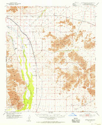
1951 Map of Cotton Center
USGS Topo · Published 1955About this map
Cotton Center and the Enterprise Ranch represent the mid-century agricultural footprint along the lower Gila River in Maricopa County. The desert landscape is defined by the critical irrigation infrastructure of the Enterprise Canal and the Gila Bend Canal, which supported settlement between the Buckeye Hills and the Maricopa Mountains.
Find a feature on this map
13 named features on this map. Tap any name to fly to it.
Don’t see what you’re looking for? This feature index may not catch every label — zoom into the map to look around manually.
Map Details
Editions of this 1951 Cotton Center Map
2 editions found
Other maps of this area

1946 · Avondale
USGS Topo · 1:62,500

1948 · Cashion
USGS Topo · 1:62,500

1950 · Theba
USGS Topo · 1:62,500

1951 · Estrella
USGS Topo · 1:62,500

1951 · Gila Bend
USGS Topo · 1:62,500

1951 · Theba
USGS Topo · 1:62,500

1951 · Mobile
USGS Topo · 1:62,500

1951 · Cotton Center
USGS Topo · 1:62,500

1951 · Woolsey Peak
USGS Topo · 1:62,500

1953 · Ajo
USGS Topo · 1:250,000