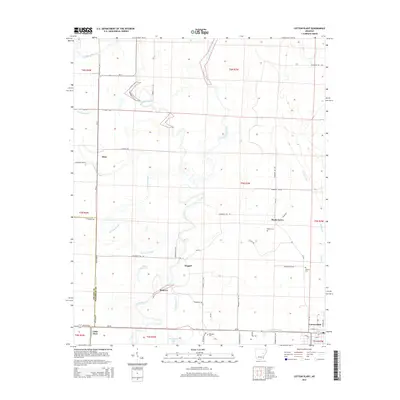
2014 Map of Cotton Plant
USGS Topo · Published 2014About this map
Cotton Plant stands as the primary hub of this eastern Arkansas landscape, situated where the southern reaches of Woodruff Co meet Prairie Co. The town's layout is defined by a grid of streets including Church St and Lynch St, serving as a focal point for the surrounding agricultural plains. The geography is dominated by the meandering path of the Cache River and its associated wetlands, such as Roaring Slough and Cache Bayou. Small rural communities like Dixie, Shady Grove, and Maberry are scattered throughout the territory, connected by a network of state routes including Ar-33 and Ar-38. Local history is preserved in several small burial grounds, including Beard Cem, Shelton Cem, and Ebenezer Cem, which mark the generational lineage of these delta settlements. Hydrological features like Little Clear Lake, Hammond Lake, and Ditch Number 1 indicate a complex system of natural waterways and drainage efforts typical of the region's river-bottom geography.
Find a feature on this map
60 named features on this map. Tap any name to fly to it.
Don’t see what you’re looking for? This feature index may not catch every label — zoom into the map to look around manually.
Map Details
Editions of this 2014 Cotton Plant Map
This is the sole edition of this map. No revisions or reprints were ever made.
Other maps of this area

1935 · Gregory
USGS Topo · 1:62,500

1939 · Hunter
USGS Topo · 1:62,500

1940 · Brinkley
USGS Topo · 1:62,500

1941 · De Valls Bluff
USGS Topo · 1:62,500

1948 · Helena
USGS Topo · 1:250,000

1950 · Helena
USGS Topo · 1:250,000

1953 · Memphis
USGS Topo · 1:250,000

1955 · Helena
USGS Topo · 1:250,000

1956 · Memphis
USGS Topo · 1:250,000

1956 · Hunter
USGS Topo · 1:62,500