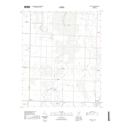
2020 Map of Cotton Plant
USGS Topo · Published 2020About this map
Cotton Plant stands as the primary hub in this corner of Woodruff County, where the agricultural grid meets the winding bottomlands of the Cache River. The landscape is defined by its drainage network, characterized by features like Roaring Slough, Cache Bayou, and Gum Flat Bayou that weave through the low-lying terrain. Smaller settlements such as Maberry, Daggett, and Dixie are scattered along the rural road network, reflecting the area's long-standing reliance on the timber and cotton economies of the Arkansas Delta. Local history and genealogy are preserved in the locations of Ebenezer Cem, Beard Cem, and Shelton Cem, which mark the community's early footprints. The presence of Ditch Number 14 and Little Clear Lake further illustrates the complex water management required in this fertile alluvial plain, where the boundary between Prairie and Woodruff Counties traces the western edge of the survey.
Find a feature on this map
50 named features on this map. Tap any name to fly to it.
Don’t see what you’re looking for? This feature index may not catch every label — zoom into the map to look around manually.
Map Details
Editions of this 2020 Cotton Plant Map
This is the sole edition of this map. No revisions or reprints were ever made.
Other maps of this area

1935 · Gregory
USGS Topo · 1:62,500

1939 · Hunter
USGS Topo · 1:62,500

1940 · Brinkley
USGS Topo · 1:62,500

1941 · De Valls Bluff
USGS Topo · 1:62,500

1948 · Helena
USGS Topo · 1:250,000

1950 · Helena
USGS Topo · 1:250,000

1953 · Memphis
USGS Topo · 1:250,000

1955 · Helena
USGS Topo · 1:250,000

1956 · Memphis
USGS Topo · 1:250,000

1956 · Hunter
USGS Topo · 1:62,500