
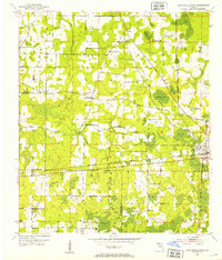
1952 Map of Cottondale West
USGS Topo · Published 1953About this map
The railroad junction at Cottondale serves as the primary hub of this North Florida landscape, where the Louisville and Nashville and Atlanta and St Andrews Bay lines intersect. The surrounding Jackson County terrain is defined by a distinct cluster of wetlands and ponds, including Drummond Bay, Big Bay, and family-named water bodies like Holland Pond and Bachelor Pond. A sparse network of early roads connects small rural settlements like Glass and several community-focused landmarks that suggest a decentralized social structure.
Find a feature on this map
30 named features on this map. Tap any name to fly to it.
Don’t see what you’re looking for? This feature index may not catch every label — zoom into the map to look around manually.
Map Details
Editions of this 1952 Cottondale West Map
2 editions found
Other maps of this area

1950 · Chipley
USGS Topo · 1:24,000

1950 · Wausau
USGS Topo · 1:24,000

1951 · Graceville
USGS Topo · 1:24,000

1951 · Chipley
USGS Topo · 1:24,000

1951 · Wausau
USGS Topo · 1:24,000

1952 · Kynesville
USGS Topo · 1:24,000

1952 · Cottondale East
USGS Topo · 1:24,000

1952 · Campbellton
USGS Topo · 1:24,000

1952 · Sills
USGS Topo · 1:24,000
1952 · Alford
USGS Topo · 1:24,000