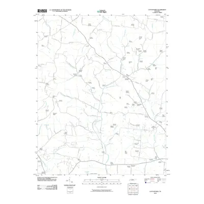
2010 Map of Cottontown
USGS Topo · Published 2010About this map
Cottontown Post Office serves as a central landmark in this portion of Sumner County, where the landscape is defined by the winding course of Station Camp Creek and its many tributaries. The area exhibits a dense pattern of family burial grounds and community landmarks, such as Palmer Chapel and the Sumner County Home. Numerous named hollows and hills, including Bursby Hollow and O'Ryan Knob, point to a long history of local land use and named topography.
Find a feature on this map
135 named features on this map. Tap any name to fly to it.
Don’t see what you’re looking for? This feature index may not catch every label — zoom into the map to look around manually.
Map Details
Editions of this 2010 Cottontown Map
This is the sole edition of this map. No revisions or reprints were ever made.
Other maps of this area

1903 · Nashville
USGS Topo · 1:125,000

1931 · Adolphus
USGS Topo · 1:62,500

1942 · Gallatin
USGS Topo · 1:100,000

1952 · Goodlettsville
USGS Topo · 1:24,000

1952 · Hendersonville
USGS Topo · 1:24,000

1953 · Cottontown
USGS Topo · 1:24,000

1953 · Orlinda
USGS Topo · 1:24,000
1954 · White House
USGS Topo · 1:24,000

1955 · Laguardo
USGS Topo · 1:24,000

1955 · Gallatin
USGS Topo · 1:24,000