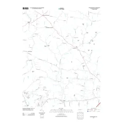
2013 Map of Cottontown
USGS Topo · Published 2013About this map
Cottontown and the crossroads settlements of Sumner County define this interior landscape of central Tennessee. The map illustrates a network of rural communities, including Walnut Grove and Ocana, linked by a web of winding county roads such as Shun Pike and Station Camp Cr. Many family-named geographic features, such as Kill Buck Knob, Pitt Hill, and O'Ryan Knob, reveal the long-standing generational ties to the land.
Find a feature on this map
138 named features on this map. Tap any name to fly to it.
Don’t see what you’re looking for? This feature index may not catch every label — zoom into the map to look around manually.
Map Details
Editions of this 2013 Cottontown Map
This is the sole edition of this map. No revisions or reprints were ever made.
Other maps of this area

1903 · Nashville
USGS Topo · 1:125,000

1931 · Adolphus
USGS Topo · 1:62,500

1942 · Gallatin
USGS Topo · 1:100,000

1952 · Goodlettsville
USGS Topo · 1:24,000

1952 · Hendersonville
USGS Topo · 1:24,000

1953 · Cottontown
USGS Topo · 1:24,000

1953 · Orlinda
USGS Topo · 1:24,000
1954 · White House
USGS Topo · 1:24,000

1955 · Laguardo
USGS Topo · 1:24,000

1955 · Gallatin
USGS Topo · 1:24,000