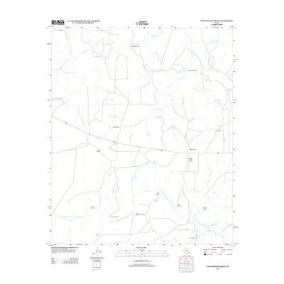
2012 Map of Cottonwood Creek
USGS Topo · Published 2012About this map
Beggs Ranch and its private Beggs Ranch Airport anchor this rural Texas landscape where water management defines the pattern of human settlement. The territory is a network of named livestock tanks and windmills, reflecting the fundamental ranching economy of Garza County in the early 21st century. High-profile water features like Five Section Tank, Bear Grass Tank, and Chestney Tank are scattered across the drainage basins of the Salt Fork Brazos River and the N Fork Double Mountain Fork Brazos River. Topographic landmarks such as Home Draw and Round Mountain Windmill provide orientation points in a region where travel relies on roads like Bird Rd and P 2880. This survey documents a working landscape where every windmill, from Slicknasty Windmill to Mare Windmill, serves as a critical node in local operations.
Find a feature on this map
48 named features on this map. Tap any name to fly to it.
Don’t see what you’re looking for? This feature index may not catch every label — zoom into the map to look around manually.
Map Details
Editions of this 2012 Cottonwood Creek Map
This is the sole edition of this map. No revisions or reprints were ever made.
Other maps of this area

1954 · Lubbock
USGS Topo · 1:250,000

1962 · Twomile Creek
USGS Topo · 1:24,000

1968 · Spur SW
USGS Topo · 1:24,000

1969 · Verbena
USGS Topo · 1:24,000

1969 · Cottonwood Creek
USGS Topo · 1:24,000

1969 · Justiceburg SE
USGS Topo · 1:24,000
1969 · Justiceburg NW
USGS Topo · 1:24,000

1969 · Justiceburg
USGS Topo · 1:24,000

1969 · T-O Creek
USGS Topo · 1:24,000
1969 · Polar
USGS Topo · 1:24,000