
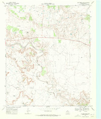
1969 Map of Justiceburg SE
USGS Topo · Published 1971About this map
The Double Mountain Fork Brazos River carves a deep path across the rugged landscape of the Texas Panhandle, marking the border between Garza and Kent counties. In the late 1960s, this region was defined by an extensive energy infrastructure, with several active petroleum extraction sites including the Dorward Oil Field, Justiceburg Oil Field, and Curt-Roy Oil Field. This survey highlights the intersection of natural drainage systems like Kildagan Creek and Sage Creek with man-made alterations, such as a prominent Pipeline and various Gravel Pits. Local ranching and oil development are reflected in named landmarks such as Birdwell and Kildagan Tank, while elevations like Cedar Hill provide natural landmarks in the broken terrain of the river valley.
Find a feature on this map
20 named features on this map. Tap any name to fly to it.
Don’t see what you’re looking for? This feature index may not catch every label — zoom into the map to look around manually.
Map Details
Editions of this 1969 Justiceburg SE Map
This is the sole edition of this map. No revisions or reprints were ever made.
Other maps of this area

1954 · Lubbock
USGS Topo · 1:250,000

1954 · Big Spring
USGS Topo · 1:250,000

1958 · Big Spring
USGS Topo · 1:250,000

1969 · Cottonwood Creek
USGS Topo · 1:24,000

1969 · Fluvanna
USGS Topo · 1:24,000
1969 · Justiceburg NW
USGS Topo · 1:24,000

1969 · Justiceburg
USGS Topo · 1:24,000

1969 · T-O Creek
USGS Topo · 1:24,000

1969 · Flat Top Mountain
USGS Topo · 1:24,000
1969 · McKenzie Mountains
USGS Topo · 1:24,000