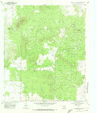
1969 Map of McKenzie Mountains
USGS Topo · Published 1972About this map
Fuller Oil Field dominates the landscape of this West Texas territory, reflecting the mid-century petroleum boom that transformed the borderlands of Kent and Scurry Counties. The dense network of oil wells and gas wells is punctuated by a central refinery and an extensive system of pipelines and an aqueduct, signaling the industrial intensity of the era. Settlement remains sparse, centered on working sites like the Fuller Ranch and its associated Fuller Landing Strip.
Find a feature on this map
20 named features on this map. Tap any name to fly to it.
Don’t see what you’re looking for? This feature index may not catch every label — zoom into the map to look around manually.
Map Details
Editions of this 1969 McKenzie Mountains Map
This is the sole edition of this map. No revisions or reprints were ever made.
Other maps of this area

1954 · Lloyd Mountain
USGS Topo · 1:24,000

1954 · Dermott
USGS Topo · 1:24,000

1954 · Brand
USGS Topo · 1:24,000

1954 · Lubbock
USGS Topo · 1:250,000

1954 · Big Spring
USGS Topo · 1:250,000

1958 · Big Spring
USGS Topo · 1:250,000

1969 · Justiceburg SE
USGS Topo · 1:24,000

1969 · Maverick Creek
USGS Topo · 1:24,000

1969 · Cooper Mountain
USGS Topo · 1:24,000

1969 · Flat Top Mountain
USGS Topo · 1:24,000