
1956 Map of Cottonwood Creek SE
USGS Topo · Published 1957About this map
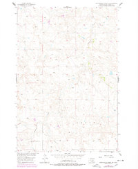
Cottonwood Creek meanders through this section of Corson County, shaping a landscape defined by dramatic elevation changes and dry drainage patterns. Produced as part of the Department of the Interior program for the development of the Missouri River Basin, this survey highlights the sparse, rural nature of the northern plains during the mid-1950s. The presence of Kern Sch in the northern portion of the map provides a specific point of interest for genealogists tracing early twentieth-century education in the region. The terrain is marked by the Cedar upland area, where numerous unimproved roads and light-duty trails connect isolated homesteads across the townships of T. 19 N. and T. 18 N..
Find a feature on this map
7 named features on this map. Tap any name to fly to it.
Don’t see what you’re looking for? This feature index may not catch every label — zoom into the map to look around manually.
Map Details
Editions of this 1956 Cottonwood Creek SE Map
2 editions found
Other maps of this area

1953 · McIntosh
USGS Topo · 1:250,000

1956 · Black Horse SW
USGS Topo · 1:24,000

1956 · Cottonwood Creek NE
USGS Topo · 1:24,000

1956 · Black Horse
USGS Topo · 1:24,000

1956 · Cottonwood Creek NW
USGS Topo · 1:24,000

1956 · Cottonwood Creek SW
USGS Topo · 1:24,000

1958 · McIntosh
USGS Topo · 1:250,000

1978 · Isabel
USGS Topo · 1:24,000

1980 · McIntosh
USGS Topo · 1:100,000
1982 · Irish Creek NW
USGS Topo · 1:24,000