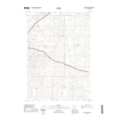
2020 Map of Cottonwood Creek
USGS Topo · Published 2020About this map
The Yellowstone River and its tributary systems define the geography of this Yellowstone County landscape. A network of historical and modern transit routes, including the Yellowstone Trl and Old Montana Rd, navigate the complex terrain. The map details a transition from the river lowlands near Diversion Dam Rd to the higher elevations and drainages further south. Local naming conventions are evident in landmarks such as Petrified Tree Pass and Spring Coulee, reflecting the area's geological and pioneer history. Waterways like Cottonwood Creek and Pryor Creek carve through the land, supported by smaller runs such as Broken Leg Creek and Three Wolf Creek. The presence of numerous named trails, including White Buffalo Rd and Shooters Bluff Trl, suggests a modern residential overlay upon the traditional ranching and river-corridor landscape.
Find a feature on this map
44 named features on this map. Tap any name to fly to it.
Don’t see what you’re looking for? This feature index may not catch every label — zoom into the map to look around manually.
Map Details
Editions of this 2020 Cottonwood Creek Map
This is the sole edition of this map. No revisions or reprints were ever made.
Other maps of this area

1893 · Huntley
USGS Topo · 1:125,000

1954 · Billings
USGS Topo · 1:250,000

1956 · Rattlesnake Butte
USGS Topo · 1:24,000

1956 · Huntley
USGS Topo · 1:24,000

1956 · Billings East
USGS Topo · 1:24,000

1957 · Billings
USGS Topo · 1:250,000

1958 · Billings
USGS Topo · 1:250,000

1967 · Worden
USGS Topo · 1:24,000

1967 · Soda Springs NW
USGS Topo · 1:24,000

1967 · Cottonwood Creek
USGS Topo · 1:24,000