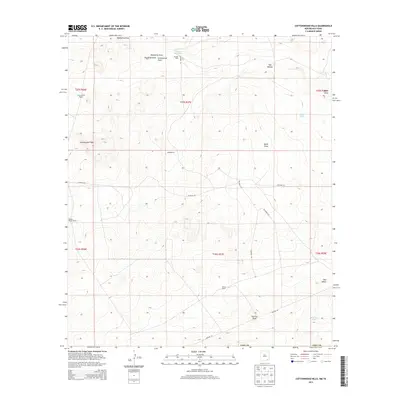
2013 Map of Cottonwood Hills
USGS Topo · Published 2013About this map
Cottonwood Hills and the rugged landscape of southern Eddy County define this arid region near the Texas border. The map reveals a land structured by drainage patterns and cattle ranching, where seasonal water features like Ward Waterhole, Apple Tank, and McBride Tank are essential landmarks in a high-desert environment. Arroyos and drainage channels, including Hackberry Draw, Red Bluff Draw, and Cottonwood Draw, crisscross the terrain, illustrating the natural flow of water toward larger basins.
Find a feature on this map
28 named features on this map. Tap any name to fly to it.
Don’t see what you’re looking for? This feature index may not catch every label — zoom into the map to look around manually.
Map Details
Editions of this 2013 Cottonwood Hills Map
This is the sole edition of this map. No revisions or reprints were ever made.
Other maps of this area

1945 · Carlsbad Caverns East
USGS Topo · 1:62,500

1945 · Malaga
USGS Topo · 1:62,500

1946 · Malaga
USGS Topo · 1:62,500

1947 · Carlsbad Caverns East
USGS Topo · 1:62,500

1954 · Carlsbad
USGS Topo · 1:250,000

1954 · Van Horn
USGS Topo · 1:250,000

1958 · Van Horn
USGS Topo · 1:250,000

1958 · Carlsbad
USGS Topo · 1:250,000

1973 · Owl Hills
USGS Topo · 1:24,000
1973 · Screw Bean Draw NE
USGS Topo · 1:24,000