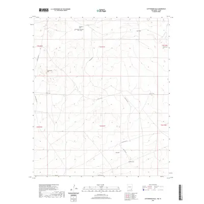
2020 Map of Cottonwood Hills
USGS Topo · Published 2020About this map
Tecolote Peak rises above a landscape defined by an intricate network of drainage channels and ephemeral water sources in this section of Eddy County. The terrain is deeply etched by Hackberry Draw, Cottonwood Red Bluff Draw Draw, and Owl Draw, reflecting the arid environment where water management was critical for ranching operations. Isolated water features like Ward Waterhole and Apple Tank provide rare points of moisture across the higher elevations of the Cottonwood Hills. The road network, including Whites City Rd and Wilhoit Ranch Rd, indicates the enduring presence of local ranching and the infrastructure required to navigate this portion of New Mexico near the Texas border.
Find a feature on this map
22 named features on this map. Tap any name to fly to it.
Don’t see what you’re looking for? This feature index may not catch every label — zoom into the map to look around manually.
Map Details
Editions of this 2020 Cottonwood Hills Map
This is the sole edition of this map. No revisions or reprints were ever made.
Other maps of this area

1945 · Carlsbad Caverns East
USGS Topo · 1:62,500

1945 · Malaga
USGS Topo · 1:62,500

1946 · Malaga
USGS Topo · 1:62,500

1947 · Carlsbad Caverns East
USGS Topo · 1:62,500

1954 · Carlsbad
USGS Topo · 1:250,000

1954 · Van Horn
USGS Topo · 1:250,000

1958 · Van Horn
USGS Topo · 1:250,000

1958 · Carlsbad
USGS Topo · 1:250,000

1973 · Owl Hills
USGS Topo · 1:24,000
1973 · Screw Bean Draw NE
USGS Topo · 1:24,000