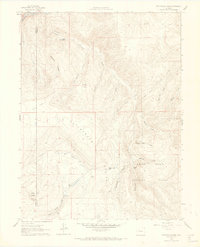
1961 Map of Cottonwood Pass
USGS Topo · Published 1968About this map
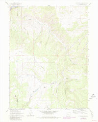
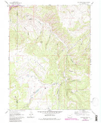
Cottonwood Divide forms a prominent natural spine through this high-country landscape on the border of Eagle and Garfield counties. The terrain is defined by a dense network of drainages such as Spruce Creek and Bob Creek, which feed into the northern reaches of the Colorado River. This 1961 survey illustrates a region largely dedicated to watershed and resource management within the White River National Forest. A lone telephone line and scattered jeep trails provide the primary human infrastructure, connecting high points like Buck Point and The Eagle Nest. Local water management is evident at Van Springs Reservoir and the Beaver Ponds near Cottonwood Pass, marking a period when these upland basins were essential for regional stock and water supplies.
Find a feature on this map
32 named features on this map. Tap any name to fly to it.
Don’t see what you’re looking for? This feature index may not catch every label — zoom into the map to look around manually.
Map Details
Editions of this 1961 Cottonwood Pass Map
7 editions found
Other maps of this area

1909 · Mount Jackson
USGS Topo · 1:125,000

1911 · Mount Jackson
USGS Topo · 1:125,000

1927 · Glenwood Springs
USGS Topo · 1:125,000

1930 · Glenwood Springs
USGS Topo · 1:125,000

1957 · Leadville
USGS Topo · 1:250,000

1959 · Leadville
USGS Topo · 1:250,000

1960 · Leadville
USGS Topo · 1:250,000

1961 · Carbondale
USGS Topo · 1:24,000

1961 · Leon
USGS Topo · 1:24,000

1961 · Cottonwood Pass
USGS Topo · 1:24,000