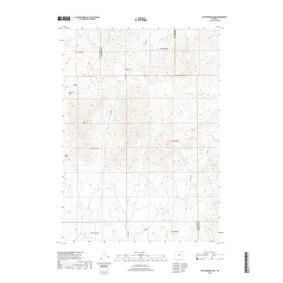
2017 Map of Cottonwood Pass
USGS Topo · Published 2017About this map
Cottonwood Pass serves as a central landmark in this high-altitude landscape where the borders of Hot Springs, Natrona, and Fremont counties converge. The terrain is defined by its water sources and drainage systems, including the Nowood River and the E Fork Lysite Cr. Named springs like Stove Spring and Brasket Spring provide vital points of interest in an area otherwise characterized by significant elevations like Lysite Mtn. This environment suggests a remote area focused on seasonal passage and livestock management, as indicated by the presence of numerous named seeps and draws. Navigational routes like the Bighorn Trl and Oakie Trl follow the contours of the land, connecting the various passes and springs that have historically supported transit across this portion of the Wyoming range.
Find a feature on this map
29 named features on this map. Tap any name to fly to it.
Don’t see what you’re looking for? This feature index may not catch every label — zoom into the map to look around manually.
Map Details
Editions of this 2017 Cottonwood Pass Map
This is the sole edition of this map. No revisions or reprints were ever made.
Other maps of this area

1952 · Cottonwood Pass
USGS Topo · 1:24,000

1952 · Badwater
USGS Topo · 1:24,000

1952 · Lysite
USGS Topo · 1:24,000

1952 · Lysite SE
USGS Topo · 1:24,000

1952 · Sioux Pass
USGS Topo · 1:24,000

1952 · Arapahoe Butte
USGS Topo · 1:24,000

1952 · Battle Mountain
USGS Topo · 1:24,000

1952 · Bull Mountain
USGS Topo · 1:24,000

1955 · Arminto
USGS Topo · 1:250,000

1958 · Arminto
USGS Topo · 1:250,000