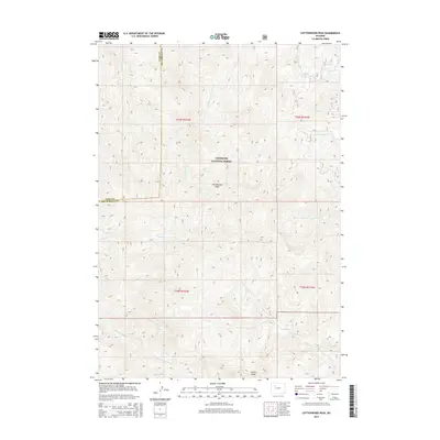
2015 Map of Cottonwood Peak
USGS Topo · Published 2015About this map
Shoshone National Forest dominates this high-elevation landscape, where the drainage divide between the Bighorn and Wind River basins is clearly defined. The terrain is anchored by Cottonwood Peak and the prominent formation of Castle Rocks to the southeast. Waterways radiate from these heights, including N Fork Owl Cr and its tributary S Fork N Fork Owl Cr flowing southward, while Cottonwood Cr and Middle Gooseberry Cr head toward the north and east. The map captures a remote section of the Wyoming wilderness where the Park Co Hot Springs Co border follows the rugged topography. To the northeast, the small alpine basins of Twin Lakes and the headwaters of Grass Cr illustrate the complex hydrology of the Absaroka Range foothills during this contemporary era.
Find a feature on this map
18 named features on this map. Tap any name to fly to it.
Don’t see what you’re looking for? This feature index may not catch every label — zoom into the map to look around manually.
Map Details
Editions of this 2015 Cottonwood Peak Map
This is the sole edition of this map. No revisions or reprints were ever made.
Other maps of this area

1904 · Kirwin
USGS Topo · 1:125,000

1906 · Kirwin
USGS Topo · 1:125,000

1955 · Thermopolis
USGS Topo · 1:250,000

1956 · Milk Creek
USGS Topo · 1:24,000

1956 · Soapy Dale Peak
USGS Topo · 1:24,000

1958 · Thermopolis
USGS Topo · 1:250,000

1962 · Thermopolis
USGS Topo · 1:250,000
1965 · Eagle Nest Ranch
USGS Topo · 1:24,000

1967 · Willow Creek
USGS Topo · 1:24,000

1967 · Monument Peak
USGS Topo · 1:24,000