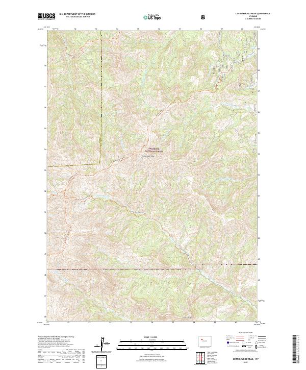
2021 Map of Cottonwood Peak
USGS Topo · Published 2021About this map
Cottonwood Peak and the surrounding high-altitude terrain of the Shoshone National Forest dominate this landscape on the border of Park and Hot Springs counties. The area is defined by its complex drainage network and high-country routes, including the Wind River Divide Trl which traverses the ridgelines. Water flows from the heights through numerous named branches such as Chimney Cr and Middle Gooseberry Cr in the north, while the southern reaches are shaped by the headwaters of N Fork Owl Cr and its tributaries.
Find a feature on this map
20 named features on this map. Tap any name to fly to it.
Don’t see what you’re looking for? This feature index may not catch every label — zoom into the map to look around manually.
Map Details
Editions of this 2021 Cottonwood Peak Map
This is the sole edition of this map. No revisions or reprints were ever made.
Other maps of this area

1904 · Kirwin
USGS Topo · 1:125,000

1906 · Kirwin
USGS Topo · 1:125,000

1955 · Thermopolis
USGS Topo · 1:250,000

1956 · Milk Creek
USGS Topo · 1:24,000

1956 · Soapy Dale Peak
USGS Topo · 1:24,000

1958 · Thermopolis
USGS Topo · 1:250,000

1962 · Thermopolis
USGS Topo · 1:250,000
1965 · Eagle Nest Ranch
USGS Topo · 1:24,000

1967 · Willow Creek
USGS Topo · 1:24,000

1967 · Monument Peak
USGS Topo · 1:24,000