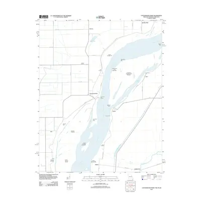
2012 Map of Cottonwood Point
USGS Topo · Published 2012About this map
The Mississippi River dominates this tri-state border region, carving through the floodplain where Tennessee, Missouri, and Arkansas meet. The landscape is defined by the river's historical shifts, evidenced by numerous bars, islands, and landings such as Cottonwood Point Landing and Heloise Landing. Small river-linked settlements like Cottonwood Point and Ayers are connected by a network of rural roads, while agricultural and engineering works like the Heloise Revetment and Cottonwood Point Dikes suggest the ongoing efforts to manage the river's power. Genealogists may find value in the locations of Hickman Cemetery and Taylor Cemetery, which sit slightly inland from the modern bank. To the south, the Obion River and Big Slough feed into the bottomlands near Bradleytown, marking a shift toward more wetland terrain and oxbow features like Half Moon Lake.
Find a feature on this map
46 named features on this map. Tap any name to fly to it.
Don’t see what you’re looking for? This feature index may not catch every label — zoom into the map to look around manually.
Map Details
Editions of this 2012 Cottonwood Point Map
This is the sole edition of this map. No revisions or reprints were ever made.
Other maps of this area

1939 · Hales Point
USGS Topo · 1:62,500

1939 · Caruthersville
USGS Topo · 1:62,500

1939 · Blytheville
USGS Topo · 1:62,500

1940 · Hayti
USGS Topo · 1:62,500

1951 · Caruthersville
USGS Topo · 1:62,500

1952 · Hales Point
USGS Topo · 1:62,500

1955 · Hayti
USGS Topo · 1:62,500

1955 · Blytheville
USGS Topo · 1:62,500

1956 · Dyersburg
USGS Topo · 1:250,000

1956 · Blytheville
USGS Topo · 1:250,000