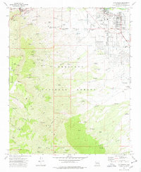
1973 Map of Cottonwood
USGS Topo · Published 1977About this map
The steep terrain of Mingus Mountain drops sharply into the Verde Valley on this mid-1970s survey, illustrating the industrial legacy of the Black Hills. In the northwest corner, the famous mining district of Jerome overlooks a landscape marked by heavy extraction, including the Verde Central Shaft and the sprawling United Verde Mine. These vertical operations contrast with the growing residential grid of Cottonwood to the east, where the town spreads out along East Mingus Ave and Cherry St.
Find a feature on this map
96 named features on this map. Tap any name to fly to it.
Don’t see what you’re looking for? This feature index may not catch every label — zoom into the map to look around manually.
Map Details
Editions of this 1973 Cottonwood Map
3 editions found
Other maps of this area

1887 · Verde
USGS Topo · 1:250,000

1887 · Prescott
USGS Topo · 1:250,000

1892 · Verde
USGS Topo · 1:250,000

1892 · Prescott
USGS Topo · 1:250,000

1905 · Jerome
USGS Topo · 1:125,000

1923 · Camp Verde
USGS Topo · 1:125,000

1932 · Camp Verde
USGS Topo · 1:125,000

1936 · Camp Verde
USGS Topo · 1:125,000

1944 · Clarkdale
USGS Topo · 1:48,000

1944 · Mingus Mountain
USGS Topo · 1:62,500