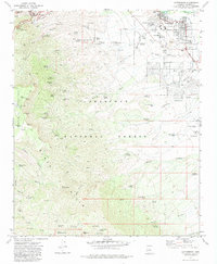
1973 Map of Cottonwood
USGS Topo · Published 1983About this map
Mining operations and high-altitude forest lands dominate this 1973 survey of the Verde Valley. The industrial footprint of the copper boom remains highly visible near Jerome, where a complex network of shafts and infrastructure including the Verde Central Shaft, Gadsden Shaft, and Verde Combination Shaft dot the slopes of the Black Hills. This vertical landscape contrasts sharply with the growing valley floor at Cottonwood, which features contemporary developments like the Cottonwood Airport, a Trailer Park, and the Mingus Union High Sch.
Find a feature on this map
94 named features on this map. Tap any name to fly to it.
Don’t see what you’re looking for? This feature index may not catch every label — zoom into the map to look around manually.
Map Details
Editions of this 1973 Cottonwood Map
3 editions found
Other maps of this area

1887 · Verde
USGS Topo · 1:250,000

1887 · Prescott
USGS Topo · 1:250,000

1892 · Verde
USGS Topo · 1:250,000

1892 · Prescott
USGS Topo · 1:250,000

1905 · Jerome
USGS Topo · 1:125,000

1923 · Camp Verde
USGS Topo · 1:125,000

1932 · Camp Verde
USGS Topo · 1:125,000

1936 · Camp Verde
USGS Topo · 1:125,000

1944 · Clarkdale
USGS Topo · 1:48,000

1944 · Mingus Mountain
USGS Topo · 1:62,500