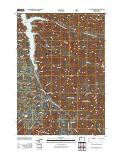
2011 Map of Cougar Reservoir
USGS Topo · Published 2011About this map
Cougar Reservoir dominates the northwestern corner of this landscape, its western shoreline fed by drainage from Basalt Creek and Annie Creek. The terrain is defined by a dense network of high ridges and narrow creek valleys, with Sawtooth Ridge and Yankee Mountain forming prominent elevations in the central portion of the quadrangle. The hydrology of the area centers on the South Fork McKenzie River, which flows into the reservoir from the south, joined by numerous tributaries including French Pete Creek and Hardy Creek. To the east, the East Fork South Fork McKenzie River carves a deep path near McLennan Mountain. Further south, the map reveals Hidden Lake and the high ground of Hardy Ridge, illustrating the complex watershed management and topography of the Willamette National Forest area as it stood in the early 21st century.
Find a feature on this map
29 named features on this map. Tap any name to fly to it.
Don’t see what you’re looking for? This feature index may not catch every label — zoom into the map to look around manually.
Map Details
Editions of this 2011 Cougar Reservoir Map
This is the sole edition of this map. No revisions or reprints were ever made.
Other maps of this area

1925 · Waldo Lake
USGS Topo · 1:125,000

1934 · Mc Kenzie Bridge
USGS Topo · 1:96,000

1940 · Mc Kenzie Bridge
USGS Topo · 1:125,000

1953 · Salem
USGS Topo · 1:250,000

1954 · Salem
USGS Topo · 1:250,000

1955 · Chucksney Mtn
USGS Topo · 1:62,500

1955 · Blue River
USGS Topo · 1:62,500

1955 · Mc Kenzie Bridge
USGS Topo · 1:62,500

1956 · Sardine Butte
USGS Topo · 1:62,500

1958 · Roseburg
USGS Topo · 1:250,000