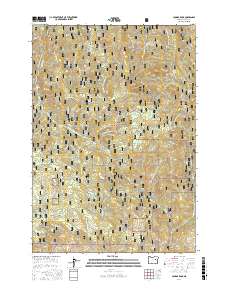
2017 Map of Cougar Rock
USGS Topo · Published 2017About this map
Malheur National Forest dominates this landscape, characterized by high-elevation terrain and a complex network of seasonal drainages and named springs. Distinctive summits like Cougar Rock, Twin Buttes, and Eagle Rock provide significant vertical relief, while Coxie Meadow offers a rare break in the timbered slopes. The drainage patterns are defined by numerous forks and creeks, including Cottonwood Creek and East Fork Beech Creek.
Find a feature on this map
37 named features on this map. Tap any name to fly to it.
Don’t see what you’re looking for? This feature index may not catch every label — zoom into the map to look around manually.
Map Details
Editions of this 2017 Cougar Rock Map
This is the sole edition of this map. No revisions or reprints were ever made.
Other maps of this area

1940 · John Day
USGS Topo · 1:62,500

1943 · John Day
USGS Topo · 1:62,500

1949 · Susanville
USGS Topo · 1:62,500

1951 · Susanville
USGS Topo · 1:62,500

1951 · Bates
USGS Topo · 1:62,500

1955 · Canyon City
USGS Topo · 1:250,000

1959 · Canyon City
USGS Topo · 1:250,000

1959 · Prairie City
USGS Topo · 1:62,500

1972 · John Day
USGS Topo · 1:24,000
1972 · Castle Creek
USGS Topo · 1:24,000