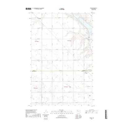
2017 Map of Coulee
USGS Topo · Published 2017About this map
Kenaston and Baden anchor the northern reaches of this North Dakota landscape, where the prairie begins its descent into the drainage systems of the Souris River valley. The geography is defined by deep incisions in the plains, most notably Baden Coulee, Mott Coulee, and Spencer Coulee, which channel runoff toward the Lower Des Lacs Lake and the Pool Five Reservoir in the northeast. This 2017 survey captures a predominantly agricultural region organized by a strict section-line grid, straddling the boundary between Ward and Mountrail counties. Near the southern edge of the map, the small settlement of Coulee sits along Main St, serving as a local hub for the surrounding ranching and farming operations. Genealogists will find the Coulee Cemetery positioned just east of the town site, a significant landmark for tracing family histories in this part of the state.
Find a feature on this map
27 named features on this map. Tap any name to fly to it.
Don’t see what you’re looking for? This feature index may not catch every label — zoom into the map to look around manually.
Map Details
Editions of this 2017 Coulee Map
This is the sole edition of this map. No revisions or reprints were ever made.
Other maps of this area

1947 · Tolley
USGS Topo · 1:62,500

1948 · Kenmare
USGS Topo · 1:24,000

1948 · Norma
USGS Topo · 1:24,000

1948 · Donnybrook
USGS Topo · 1:24,000

1949 · Mosquito Butte
USGS Topo · 1:24,000

1949 · Niobe
USGS Topo · 1:24,000

1949 · Coulee
USGS Topo · 1:24,000

1950 · Kenmare
USGS Topo · 1:62,500

1950 · Tolley
USGS Topo · 1:62,500

1953 · Williston
USGS Topo · 1:250,000