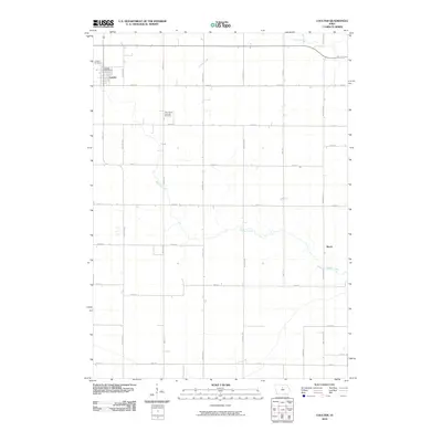
2010 Map of Coulter
USGS Topo · Published 2010About this map
Coulter serves as the primary settlement in this section of Franklin County, characterized by a highly organized grid of rural roads and fertile agricultural land. The town center is anchored by the Coulter Post Office, with the nearby Coulter Cemetery situated just to the northwest. Beyond the residential grid, the landscape is defined by the winding paths of Squaw Creek and Maynes Creek, which provide a natural contrast to the strictly linear path of local thoroughfares like Gull Ave and 140th St. To the southeast, the small community of Reeve sits near the banks of Maynes Creek. This survey captures a moment in the early 21st century when the region's Lutheran heritage remained visible at Saint Johns Lutheran Cemetery, reflecting the long-standing community ties that shaped this pocket of north-central Iowa.
Find a feature on this map
26 named features on this map. Tap any name to fly to it.
Don’t see what you’re looking for? This feature index may not catch every label — zoom into the map to look around manually.
Map Details
Editions of this 2010 Coulter Map
This is the sole edition of this map. No revisions or reprints were ever made.
Other maps of this area

1954 · Waterloo
USGS Topo · 1:250,000

1955 · Waterloo
USGS Topo · 1:250,000

1972 · Alexander
USGS Topo · 1:24,000

1972 · Latimer
USGS Topo · 1:24,000

1972 · Hampton North
USGS Topo · 1:24,000

1979 · Dows East
USGS Topo · 1:24,000

1979 · Coulter
USGS Topo · 1:24,000

1979 · Iowa Falls West
USGS Topo · 1:24,000

1979 · Popejoy
USGS Topo · 1:24,000

1979 · Iowa Falls East
USGS Topo · 1:24,000