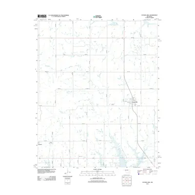
2012 Map of Council Hill
USGS Topo · Published 2012About this map
Council Hill stands as the primary hub in this portion of Muskogee County, with its grid of streets including Main St and 4th St forming a small-town center amidst the rural Oklahoma landscape. The terrain is defined by a dendritic network of waterways such as Cloud Cr, Gentry Cr, and Walnut Cr, which wind through agricultural fields and scattered timber. To the southwest, the community of Hitchita anchors the corner of the map, connected to the surrounding countryside by a dense section-line road network. Genealogists and local historians will find significant value in the distribution of burial grounds across the area, from the Council Hill Cem near the town center to the Ridley Cem and Hitchita Lackey Cem further south. These features, along with High Spring, reflect a long-standing settlement pattern tied to the region's water sources and early transport routes.
Find a feature on this map
41 named features on this map. Tap any name to fly to it.
Don’t see what you’re looking for? This feature index may not catch every label — zoom into the map to look around manually.
Map Details
Editions of this 2012 Council Hill Map
This is the sole edition of this map. No revisions or reprints were ever made.
Other maps of this area

1896 · Okmulgee
USGS Topo · 1:125,000

1900 · Canadian
USGS Topo · 1:125,000

1900 · Okmulgee
USGS Topo · 1:125,000

1946 · Fort Smith
USGS Topo · 1:250,000

1962 · Pierce
USGS Topo · 1:24,000

1962 · Hoffman
USGS Topo · 1:24,000

1963 · Checotah
USGS Topo · 1:24,000

1965 · Fort Smith
USGS Topo · 1:250,000

1967 · Fort Smith
USGS Topo · 1:250,000
1970 · Wainwright
USGS Topo · 1:24,000