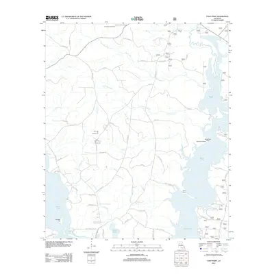
2012 Map of Coup Point
USGS Topo · Published 2012About this map
The Black Lake Oil and Gas Field defines the industrial landscape of this Natchitoches Parish region, where heavy extraction infrastructure sits alongside the intricate wetlands of the Red River valley. The area is dominated by the sprawling waters of Saline Lake and Black Lake, which are fed by a complex network of tributaries including Big Fordoche Cr, Little Fordoche Cr, and Cheechee Cr. These water bodies create a distinctive geography of points and landings, notably Coup Point and Burnt Pine Point.
Find a feature on this map
79 named features on this map. Tap any name to fly to it.
Don’t see what you’re looking for? This feature index may not catch every label — zoom into the map to look around manually.
Map Details
Editions of this 2012 Coup Point Map
This is the sole edition of this map. No revisions or reprints were ever made.
Other maps of this area

1937 · Campti NE
USGS Topo · 1:31,680

1937 · Campti SE
USGS Topo · 1:31,680

1944 · Campti
USGS Topo · 1:62,500

1947 · Goldonna
USGS Topo · 1:62,500

1947 · Ashland
USGS Topo · 1:62,500

1948 · Campti
USGS Topo · 1:62,500

1949 · Calvin SE
USGS Topo · 1:31,680

1949 · Calvin NE
USGS Topo · 1:31,680

1949 · Calvin NW
USGS Topo · 1:31,680

1949 · Calvin SW
USGS Topo · 1:31,680