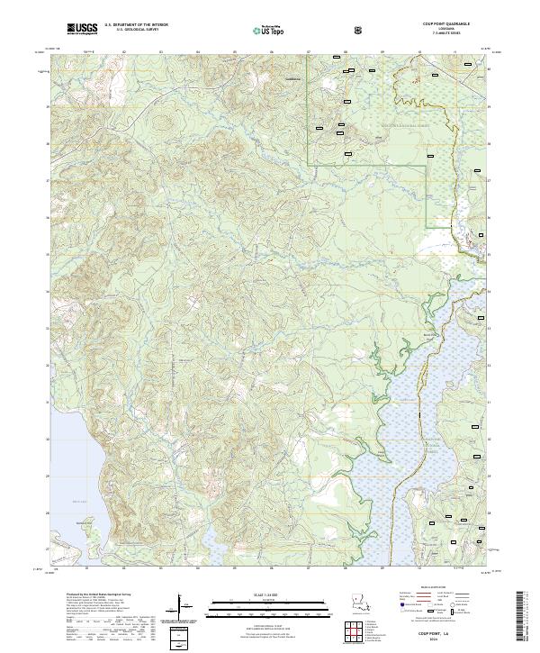
2024 Map of Coup Point
USGS Topo · Published 2024About this map
Goldonna sits at the northern edge of a complex landscape where the bottomlands of the Saline Bayou Wild and Scenic River meet the upland reaches of the Kisatchie National Forest. This modern record reveals a detailed network of parish roads and land tracks, such as Goldonna Rd and Rice Rd, that weave through the pine-dominated terrain of Natchitoches and Winn Parishes. The eastern boundary is defined by the expansive wetlands of Saline Lake, while Black Lake occupies the southwestern corner, showing the enduring importance of these water bodies to local geography. Landmarks like Coup Point and Burnt Pine Point highlight the irregular shoreline where the bayou system expands into lake beds. Numerous named drainage features, including Little Fordoche Creek and Cheechee Creek, illustrate the intricate hydrology that has historically dictated settlement patterns and access in this part of Louisiana.
Find a feature on this map
65 named features on this map. Tap any name to fly to it.
Don’t see what you’re looking for? This feature index may not catch every label — zoom into the map to look around manually.
Map Details
Editions of this 2024 Coup Point Map
This is the sole edition of this map. No revisions or reprints were ever made.
Other maps of this area

1937 · Campti NE
USGS Topo · 1:31,680

1937 · Campti SE
USGS Topo · 1:31,680

1944 · Campti
USGS Topo · 1:62,500

1947 · Goldonna
USGS Topo · 1:62,500

1947 · Ashland
USGS Topo · 1:62,500

1948 · Campti
USGS Topo · 1:62,500

1949 · Calvin SE
USGS Topo · 1:31,680

1949 · Calvin NE
USGS Topo · 1:31,680

1949 · Calvin NW
USGS Topo · 1:31,680

1949 · Calvin SW
USGS Topo · 1:31,680