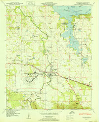
1951 Map of Courtland
USGS Topo · Published 1951About this map
Courtland Air Base dominates the southwestern quadrant of this mid-century survey, its expansive airfield layout and auxiliary facilities like the Firing range and Substation showing the military footprint on the Lawrence County landscape. Just to the northeast, the town of Courtland serves as a local hub where the Southern railway and Joe Wheeler Highway converge. The northern reaches are defined by the wide expanse of the Wheeler Reservoir on the Tennessee River, where the flooding of the basin transformed former bottomlands into inlets at Spring Creek and Big Nance Creek.
Find a feature on this map
86 named features on this map. Tap any name to fly to it.
Don’t see what you’re looking for? This feature index may not catch every label — zoom into the map to look around manually.
Map Details
Editions of this 1951 Courtland Map
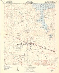
2 editions found
Other maps of this area

1914 · Rogersville
USGS Topo · 1:48,000

1916 · Rogersville
USGS Topo · 1:62,500

1936 · Caddo
USGS Topo · 1:24,000

1936 · Thorntontown
USGS Topo · 1:24,000

1936 · Courtland
USGS Topo · 1:24,000

1936 · Hillsboro
USGS Topo · 1:24,000

1936 · Wheeler Dam
USGS Topo · 1:24,000

1936 · Town Creek
USGS Topo · 1:24,000

1936 · Cairo
USGS Topo · 1:24,000

1936 · Masterson
USGS Topo · 1:24,000