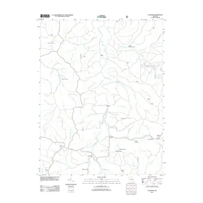
2011 Map of Courtois
USGS Topo · Published 2011About this map
Courtois Creek and its many tributaries, including Hazel Creek and Little Shoal Creek, carve a complex drainage pattern through this section of the Ozarks. Small, isolated settlements like Brazil, Ishmael, and Quaker are connected by a network of rural routes such as State Hwy Y and family-named roads like Hanson Farm Rd. The landscape is marked by the presence of historical community centers, notably the Antioch Cemetery and Joseph Chapel Cemetery. Evidence of local resource management and early infrastructure appears in the form of the Czar Lookout Tower and multiple water control structures like Number 717 Dam. Geologic and historical points of interest, such as Iron Ore Spring and Boiling Springs Hollow, indicate the natural features that likely influenced early land use and settlement patterns in this region.
Find a feature on this map
54 named features on this map. Tap any name to fly to it.
Don’t see what you’re looking for? This feature index may not catch every label — zoom into the map to look around manually.
Map Details
Editions of this 2011 Courtois Map
This is the sole edition of this map. No revisions or reprints were ever made.
Other maps of this area

1906 · Potosi
USGS Topo · 1:62,500

1924 · Edgehill
USGS Topo · 1:62,500

1926 · Edgehill
USGS Topo · 1:62,500

1943 · Berryman
USGS Topo · 1:62,500

1943 · Boss
USGS Topo · 1:62,500

1945 · Berryman
USGS Topo · 1:62,500

1946 · Boss
USGS Topo · 1:62,500

1949 · Rolla
USGS Topo · 1:250,000

1953 · Rolla
USGS Topo · 1:250,000

1954 · Rolla
USGS Topo · 1:250,000