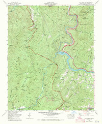
1967 Map of Cove Creek Gap
USGS Topo · Published 1970About this map
Great Smoky Mountains National Park and the Pisgah National Forest converge in this high-altitude corner of Western North Carolina, where the Pigeon River carves a deep valley north toward Tennessee. The landscape is defined by its conservation history, with the Harmon Den Wildlife Management Area occupying the northeastern ridges. The presence of numerous family burial grounds, such as Sutton Cem, Hannah Cem, and Caldwell Cem, indicates the footprint of late 19th and early 20th-century mountain communities that were later incorporated into the federal park system.
Find a feature on this map
88 named features on this map. Tap any name to fly to it.
Don’t see what you’re looking for? This feature index may not catch every label — zoom into the map to look around manually.
Map Details
Editions of this 1967 Cove Creek Gap Map
4 editions found
Other maps of this area

1893 · Mt Guyot
USGS Topo · 1:125,000

1894 · Asheville
USGS Topo · 1:125,000

1901 · Asheville
USGS Topo · 1:125,000

1912 · Mt Guyot
USGS Topo · 1:125,000

1935 · Newport
USGS Topo · 1:48,000

1935 · Hartford
USGS Topo · 1:24,000

1935 · Dellwood
USGS Topo · 1:24,000

1935 · Clyde
USGS Topo · 1:24,000

1935 · Lemon Gap
USGS Topo · 1:24,000

1936 · Bunches Bald
USGS Topo · 1:24,000