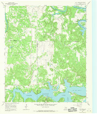
1967 Map of Cove Creek
USGS Topo · Published 1970About this map
The Brazos River meanders sharply through this North Texas landscape, defining the borders between Young, Stephens, and Palo Pinto counties. In the late 1960s, the river’s course was punctuated by dramatic loops like Salem Bend and Brier Bend, while the southern portion of the map is dominated by the expansive Possum Kingdom Lake. This reservoir landscape includes Possum Kingdom State Park and recreation areas such as Sandy Beach and Poor Bend.
Find a feature on this map
25 named features on this map. Tap any name to fly to it.
Don’t see what you’re looking for? This feature index may not catch every label — zoom into the map to look around manually.
Map Details
Editions of this 1967 Cove Creek Map
2 editions found
Other maps of this area

1890 · Breckenridge
USGS Topo · 1:125,000

1891 · Palo Pinto
USGS Topo · 1:125,000

1918 · Palo Pinto
USGS Topo · 1:125,000

1924 · Breckenridge 1-a
USGS Topo · 1:48,000

1924 · Palo Pinto 2-b
USGS Topo · 1:48,000

1924 · Graham 4-d
USGS Topo · 1:48,000

1924 · Palo Pinto 2-c
USGS Topo · 1:48,000

1924 · Breckenridge 1-d
USGS Topo · 1:48,000

1925 · Graham 4-c
USGS Topo · 1:48,000

1925 · Breckenridge 1-b
USGS Topo · 1:48,000