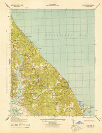
1943 Map of Cove Point
USGS Topo · Published 1943About this map
Cove Point L H and the adjacent Cove Point Beach define the southeastern tip of this 1943 War Department survey, showing the Calvert County peninsula during a period of significant military presence. This wartime era is reflected in the establishment of Camp Conoy and a large U S Army Camp near the point. Inland, the rural character of the region is preserved through historic social centers like Middleham Chapel, St Johns Church, and St Pauls Church. The intricate shoreline along the Chesapeake Bay and St Leonard Creek reveals a landscape tied to the water, where small settlements like Lusby, Bertha, and Sollers are connected by Cove Point Road and Wharf Road. Navigable waters are dotted with family-named landmarks such as Rollins Cove and Mears Creek, while industrial vestiges like Planters Whf hint at the coastal trade that sustained these communities before modernization.
Find a feature on this map
48 named features on this map. Tap any name to fly to it.
Don’t see what you’re looking for? This feature index may not catch every label — zoom into the map to look around manually.
Map Details
Editions of this 1943 Cove Point Map
4 editions found
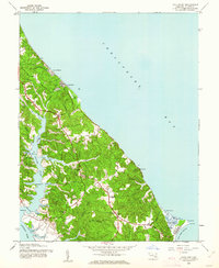
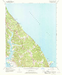

Other maps of this area

1892 · Leonardtown
USGS Topo · 1:62,500

1892 · Drum Point
USGS Topo · 1:62,500

1892 · Prince Frederick
USGS Topo · 1:62,500

1893 · Sharps Island
USGS Topo · 1:62,500

1895 · Prince Frederick
USGS Topo · 1:62,500

1895 · Leonardtown
USGS Topo · 1:62,500

1895 · Nomini
USGS Topo · 1:125,000

1898 · Choptank
USGS Topo · 1:125,000

1898 · Nomini
USGS Topo · 1:125,000

1898 · St. Marys
USGS Topo · 1:125,000