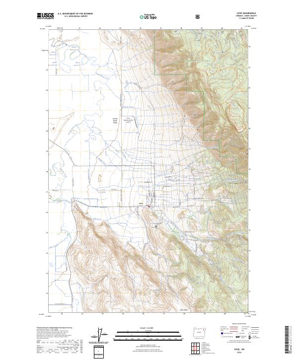
2024 Map of Cove
USGS Topo · Published 2024About this map
The settlement of Cove sits at the foot of the eastern mountains where the Grande Ronde Valley meets the timbered slopes of the Whitman National Forest. This topography creates a unique hydraulic landscape, where the Grande Ronde River and Catherine Creek feed a complex network of agricultural irrigation, including the Catherine Creek Highline Canal and multiple storage basins like Elmers Reservoir 1. The town itself is centered on Main St, serving as a gateway between the valley floor and the high-elevation settlements like High Valley to the south.
Find a feature on this map
71 named features on this map. Tap any name to fly to it.
Don’t see what you’re looking for? This feature index may not catch every label — zoom into the map to look around manually.
Map Details
Editions of this 2024 Cove Map
This is the sole edition of this map. No revisions or reprints were ever made.
Other maps of this area

1906 · Telocaset
USGS Topo · 1:125,000

1955 · Grangeville
USGS Topo · 1:250,000

1959 · Grangeville
USGS Topo · 1:250,000

1965 · Conley
USGS Topo · 1:24,000

1965 · Union
USGS Topo · 1:24,000

1965 · Cove
USGS Topo · 1:24,000
1965 · Gasset Bluff
USGS Topo · 1:24,000
1965 · Imbler
USGS Topo · 1:24,000
1965 · Mount Moriah
USGS Topo · 1:24,000

1965 · Little Catherine Creek
USGS Topo · 1:24,000