
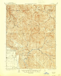
1926 Map of Covelo
USGS Topo · Published 1926About this map
Round Valley and the Round Valley Indian Reservation dominate the southwestern corner of this survey, anchored by the settlement of Covelo. This high-altitude mountain valley provides a sharp contrast to the surrounding terrain of the California National Forest, which is defined by a dense network of ridges such as Bean Ridge and Anthony Ridge. The Middle Fork Eel River and Black Butte River cut deep through these ranges, creating a landscape that necessitated early remote outposts like the Osborn Ranger Sta and Montague Ranger Sta.
Find a feature on this map
56 named features on this map. Tap any name to fly to it.
Don’t see what you’re looking for? This feature index may not catch every label — zoom into the map to look around manually.
Map Details
Editions of this 1926 Covelo Map
2 editions found
Other maps of this area

1890 · Red Bluff
USGS Topo · 1:250,000

1894 · Red Bluff
USGS Topo · 1:250,000

1920 · Covelo
USGS Topo · 1:62,500

1921 · Hoaglin
USGS Topo · 1:62,500

1922 · Island Mountain
USGS Topo · 1:62,500

1929 · Eden Valley
USGS Topo · 1:62,500

1931 · Hoaglin
USGS Topo · 1:96,000

1935 · Hoaglin
USGS Topo · 1:125,000

1951 · Laytonville
USGS Topo · 1:62,500

1952 · Hull Mountain
USGS Topo · 1:62,500