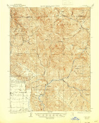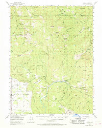
1981 Map of Covelo
USGS Topo · Published 1988About this map
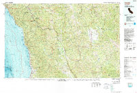
The Round Valley Indian Reservation and its central settlement of Covelo anchor this 1980s landscape, illustrating a complex pattern of tribal land, federal forests, and private ranching. This edition provides a rare dual perspective by combining traditional topographic data with bathymetric soundings of the Pacific Ocean coastline, revealing the underwater depths of Noyo Canyon. Inland, the rugged geography is defined by the winding Eel River and its various forks, which carved deep valleys through Jackson Ridge and Timber Ridge. This era shows the Northwestern Pacific RR following the river corridor near Nashmead, a vital transport link for the timber industry before the decline of northern California's rail networks. From the redwood groves of Smithe Redwoods State Reserve to the coastal sites of Westport and Kibesillah, the map documents the diverse terrain of northern Mendocino County at a time when remote outposts like Piercy and Laytonville served as the primary hubs for those navigating the Pacific Highway.
Find a feature on this map
42 named features on this map. Tap any name to fly to it.
Don’t see what you’re looking for? This feature index may not catch every label — zoom into the map to look around manually.
Map Details
Editions of this 1981 Covelo Map
2 editions found

Historical Maps of Leggett Through Time
4 maps found