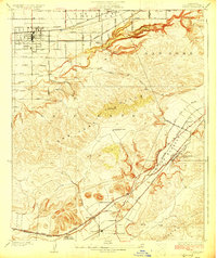
1927 Map of Covina
USGS Topo · Published 1927About this map
The citrus-growing landscapes of Covina and Charter Oak are showcased in this mid-1920s survey, illustrating the transformation of the eastern San Gabriel Valley. The map captures a transition from large rancho-era tracts like Rincon De La Brea and the Diamond Bar Ranch to organized suburban blocks and industrial corridors. Transport infrastructure is particularly dense, with the Pacific Electric and Southern Pacific railroads cutting through the basin to serve the agricultural economy.
Find a feature on this map
31 named features on this map. Tap any name to fly to it.
Don’t see what you’re looking for? This feature index may not catch every label — zoom into the map to look around manually.
Map Details
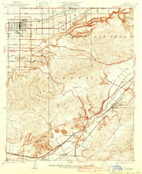
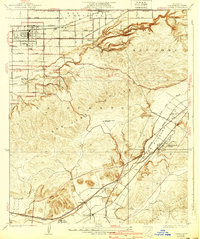
Editions of this 1927 Covina Map
3 editions found
Other maps of this area

1894 · Pomona
USGS Topo · 1:62,500

1896 · Anaheim
USGS Topo · 1:62,500

1897 · Pomona
USGS Topo · 1:62,500

1898 · Pomona
USGS Topo · 1:62,500

1898 · Anaheim
USGS Topo · 1:62,500

1901 · Southern California Sheet No. 1
USGS Topo · 1:250,000

1901 · Anaheim
USGS Topo · 1:62,500

1902 · Corona
USGS Topo · 1:125,000

1904 · Pomona
USGS Topo · 1:62,500

1904 · Southern California Sheet No. 1
USGS Topo · 1:250,000