1968 Map of Covington SW
USGS Topo · Published 1977About this map
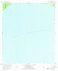
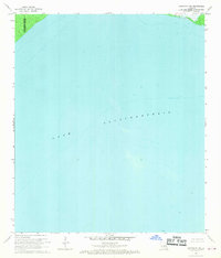
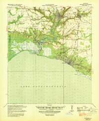
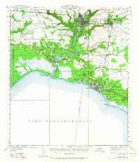
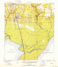
Lake Pontchartrain dominates this mid-century hydrographic survey, illustrating the vast aquatic expanse south of the Louisiana shoreline. The map focuses on the open waters of the basin, providing soundings and depth curves that were crucial for navigation and coastal study. Along the northern edge, a narrow strip of land reveals the boundary between Tangipahoa Parish and St Tammany Parish. These shoreline fragments provide rare glimpses of the marshy terrestrial fringe where the parishes meet the lake. Several navigation markers, each simply labeled Light, are positioned across the water to guide vessels. This sheet is particularly valuable for those studying the 1960s coastline and the precise underwater topography of the lake before subsequent decades of coastal change.
Find a feature on this map
3 named features on this map. Tap any name to fly to it.
Don’t see what you’re looking for? This feature index may not catch every label — zoom into the map to look around manually.
Map Details
Editions of this 1968 Covington SW Map
2 editions found
Other maps of this area

1891 · Spanish Fort
USGS Topo · 1:62,500

1892 · Bonnet Carre
USGS Topo · 1:62,500

1935 · Covington
USGS Topo · 1:62,500
1935 · Ponchatoula
USGS Topo · 1:62,500

1936 · Bonnet Carre
USGS Topo · 1:62,500

1936 · Spanish Fort
USGS Topo · 1:62,500
1939 · Ponchatoula
USGS Topo · 1:62,500
1939 · Covington
USGS Topo · 1:62,500
1950 · Covington
USGS Topo · 1:62,500
1951 · Ponchatoula
USGS Topo · 1:62,500